Pee Dee Tour

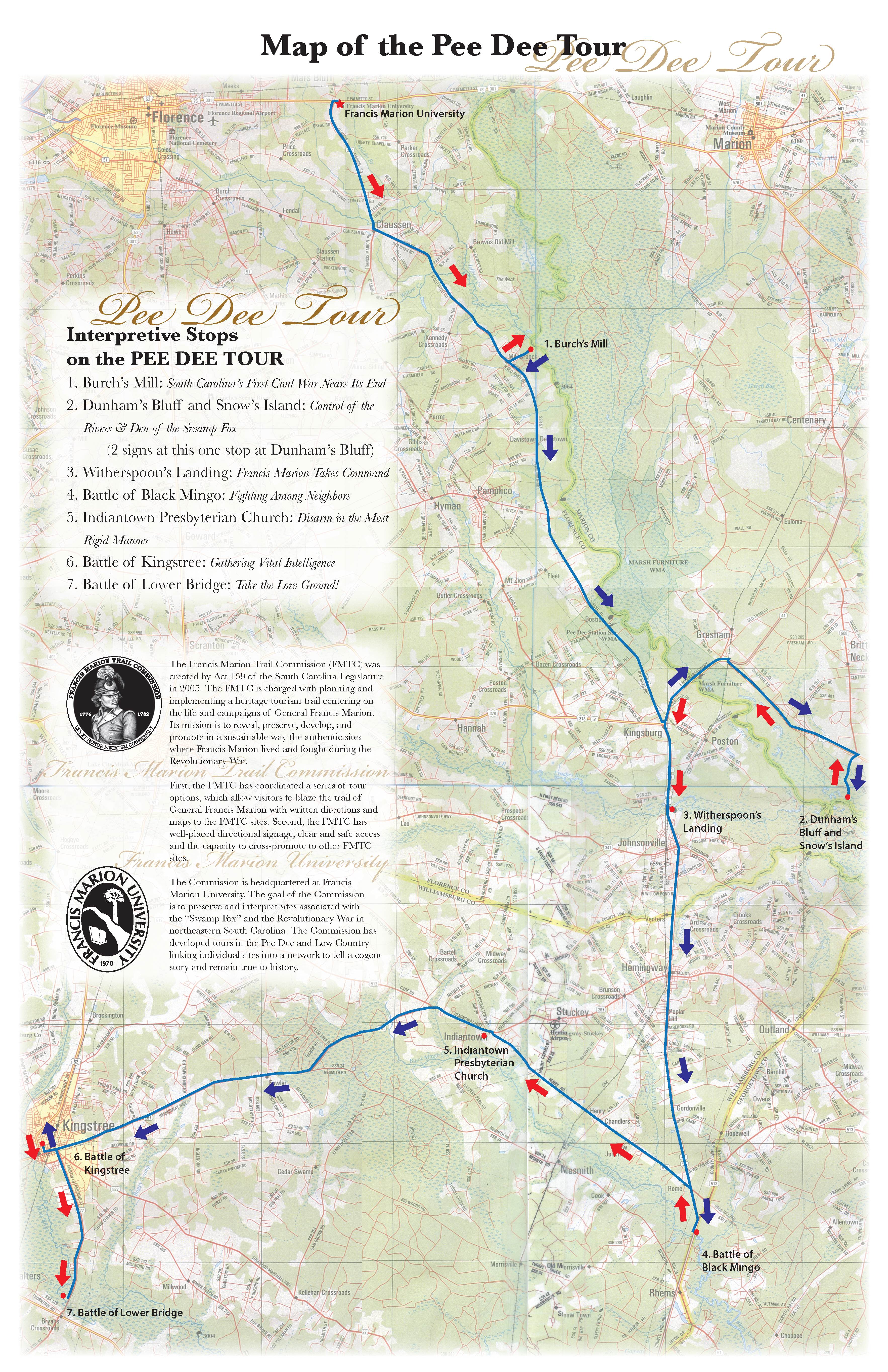
Encompassing portions of Florence, Marion, Georgetown, and Williamsburg Counties, the Pee Dee Tour includes seven sites along the Great Pee Dee River and several of its tributaries. Among the sites on this tour are the scenes of some of Marion’s first acts as a partisan leader at Witherspoon’s Ferry, Kingstree, and Black Mingo Creek, as well as one of his last, the signing of a peace treaty with a local Tory leader at Burch’s Mill. Along the way, stop for lunch or dinner at one of the nationally-famous barbeque restaurants in Hemingway and Johsonville; take a kayak out on the Lynches River or Black Mingo Creek; and stroll through the charming historic district of downtown Kingstree.
STOP 1: Burch’s Mill
Leaving the Francis Marion University Educational Foundation Building on Palmetto Street you will turn towards the Francis Marion University main entrance. Proceed 1 block on Palmetto Street and turn right at the intersection of Palmetto Street and Francis Marion Road. Follow this road for 5 miles. At the intersection of Francis Marion Road and Old River Road, you turn left onto Old River Road and proceed 7.2 miles until you get to Mill Branch Road. This is a dirt road across from Mill Branch A.M.E. Church (red brick church on the right side of the highway). You will turn left and proceed down this dirt road for 1.2 miles until you come to a stop sign at the Great Pee Dee River. This is a bluff so proceed carefully. Your travel time from the Educational Foundation Building is about 22 minutes. *The interpretive panel is not currently installed. You may still enjoy the area and learn about Francis Marion and his adventures in the region.*
- A War Among Neighbors
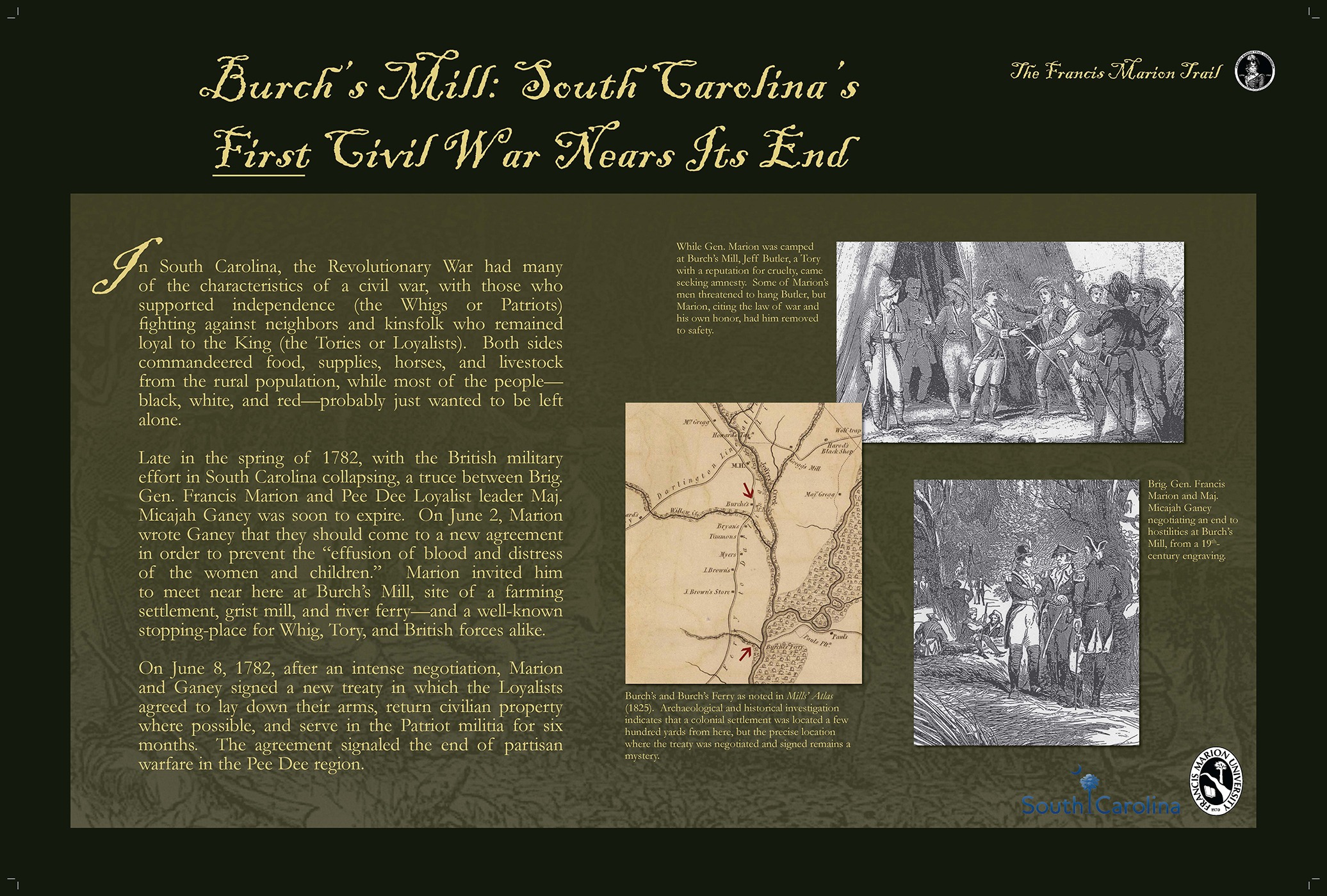
In South Carolina, the Revolutionary War had many of the characteristics of a civil war, with those who supported independence, (the Whigs or Patriots) fighting against neighbors and kinsfolk who remained loyal to the King (the Tories or Loyalists). Both sides commandeered food, supplies, horses, and livestock from the rural population, while most of the people ~ black, white, and red ~ probably just wanted to be left alone.
- A Call for Peace at Burch’s Mill
Late in the spring of 1782, with the British military efforts in South Carolina collapsing, a treaty between Brig. Gen. Francis Marion and Pee Dee Loyalist leader, Maj. Micaiah Ganey, was soon to expire. On June 2 Marion wrote Ganey that they should come to a new agreement in order to prevent the “effusion of blood and distress of the women and children.” Marion invited him to meet near here at Burch’s Mill, site of a farming settlement, grist mill, and river ferry ~ and a well known stopping place for Whig, Tory and British forces alike.
- Treaty of Burch’s Mill
On June 8, 1782, after an intense negotiation, Marion and Ganey signed a new treaty in which the loyalist agreed to lay down their arms, return civilian property where possible, and serve in the Patriot Militia for six months. The agreement signaled the end of partisan warfare in the Pee Dee region.
STOP 2: Dunham’s Bluff and Snow’s Island
Return to the intersection of Mill Branch Road and Old River Road, turn left onto Old River Road, drive 13.7 miles to Hwy. 378 and turn left onto Hwy. 378. Proceed 9 miles on Hwy. 378 (crossing over the Great Pee Dee River) to Bluff Road and turn right onto Bluff Road. (Note: Bluff Road is a dirt road a few yards across the highway from a convenience store called “Park and Blow.”) You will go 1.7 miles down this dirt road to Dunham’s Bluff Landing. *The interpretive panel is not currently installed. You may still enjoy the area and learn about Francis Marion and his adventures in the region.*
- Marion’s Stronghold Across the Pee Dee
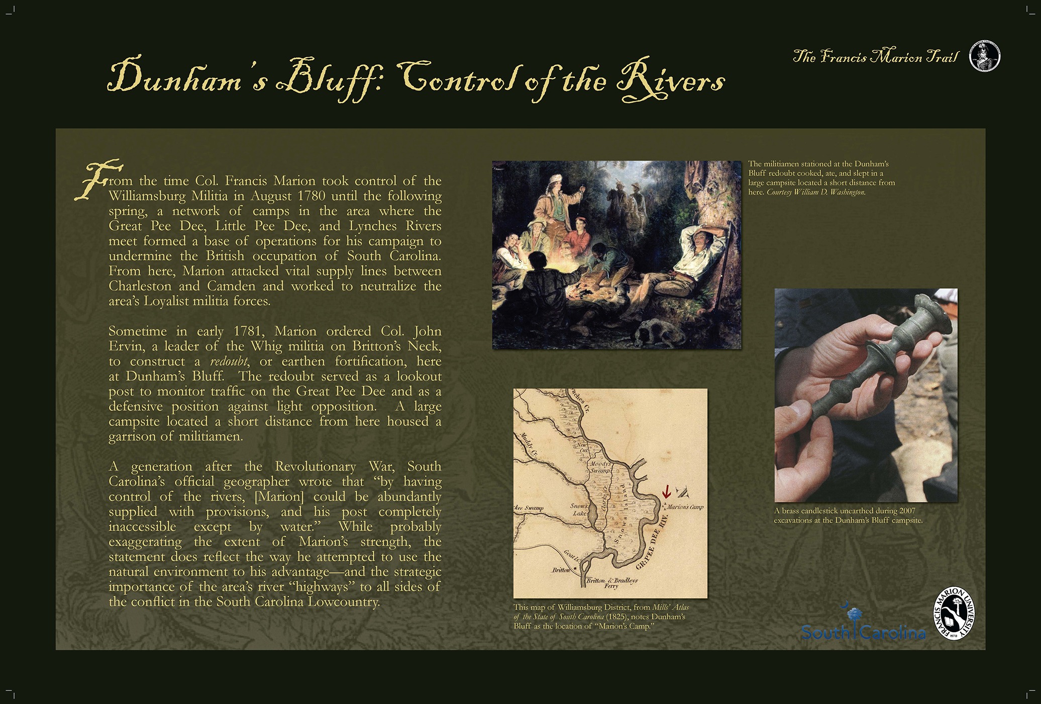
Perhaps no place is more closely associated with Francis Marion’s Revolutionary War career than his legendary camp on Snow’s Island, the large, thickly forested landmass in front of you across the Great Pee Dee River.
- Why Snow’s Island Was Ideal
With plenty of high, dry ground protected on all sides by water and marshland, an abundance of fish and game, and friendly Whig settlements nearby, Snow’s Island was an ideal location for a secluded base. In Marion’s day, the canopy of the enormous old trees probably hindered the growth of an understory, and horsemen could ride freely across much of the island.
- Base of Operations and British Raid
From the fall of 1780 to the spring of 1781, Francis Marion used a large camp somewhere on Snow’s Island ~ together with outposts at Port’s Ferry and here at Dunham’s Bluff ~ as his main base of operations against British and Loyalist forces in eastern South Carolina. After British soldiers raided the Snow’s Island camp at the end of March 1781, Marion’s campaign shifted away from this area.
- A Lost Camp in a Changing Landscape
The island’s sheer size, the difficulty of the terrain, and the alteration of the landscape through generations of forestry have all made archaeological investigation particularly difficult. So far, the precise location of Marion’s Snow’s Island camp remains a mystery.
STOP 3: Witherspoon’s Landing
Retrace your route back to Dunham’s Bluff Road and turn left onto Hwy. 378 (at the “Park and Blow.”) Go 9 miles to the intersection of Hwy. 378 and Hwy. 41 (River Road) and turn left at the light. Proceed 3.2 miles and cross over Lynches River. You will take an immediate left into Witherspoon’s Landing (now named Venter’s Landing) which is a popular boat launch area on the Lynches River. The sign telling you about this site is on the right close to the statue of Francis Marion. Travel time is about 20 minutes from Dunham’s Bluff.
- Gates’ Southern Advance
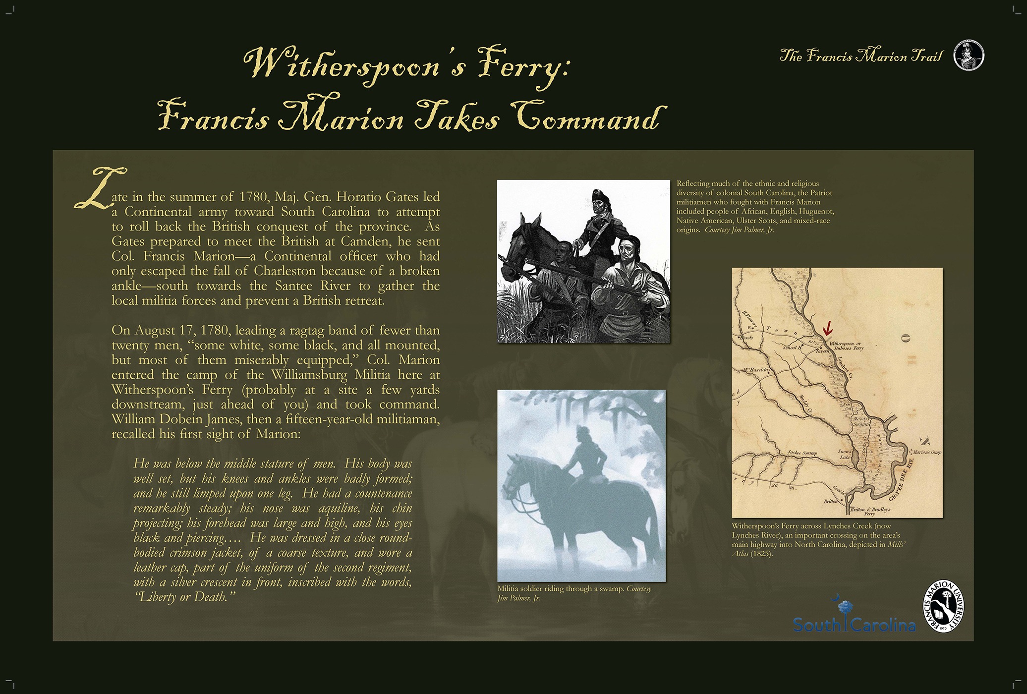
Late in the summer of 1780, Maj. Gen. Horatio Gates led a Continental army toward South Carolina to attempt to roll back the British conquest of the province. As Gates prepared to meet the British at Camden, he sent Col. Francis Marion ~ a Continental officer who had only escaped the fall of Charleston because of a broken ankle ~ south towards the Santee River to gather the local militia forces and prevent a British retreat.
- Marion Takes Command at Witherspoon’s Ferry
On August 17, 1780, leading a ragtag band of fewer than twenty men, “some white, some black, and all mounted, but most of them miserably equipped,” Col. Marion entered the camp of the Williamsburg Militia here at Witherspoon’s Ferry (probably at a site a few yards downstream, just ahead of you) and took command. William Dobein James, then a fifteen-year-old militiaman, recalled his first sight of Marion:
- A First Glimpse of the Swamp Fox
He was below the middle stature of men. His body was well set, but his knees and ankles were badly formed; and he still limped upon one leg. He had a countenance remarkably steady; his nose was aquiline, his chin projecting; his forehead was large and high. And his eyes black and piercing…. He was dressed in a close round-bodied crimson jacket, of a coarse texture, and wore a leather cap, part of the uniform of the second regiment, with a silver crescent in front, inscribed with the words, “Liberty or Death.”
STOP 4: Battle of Black Mingo
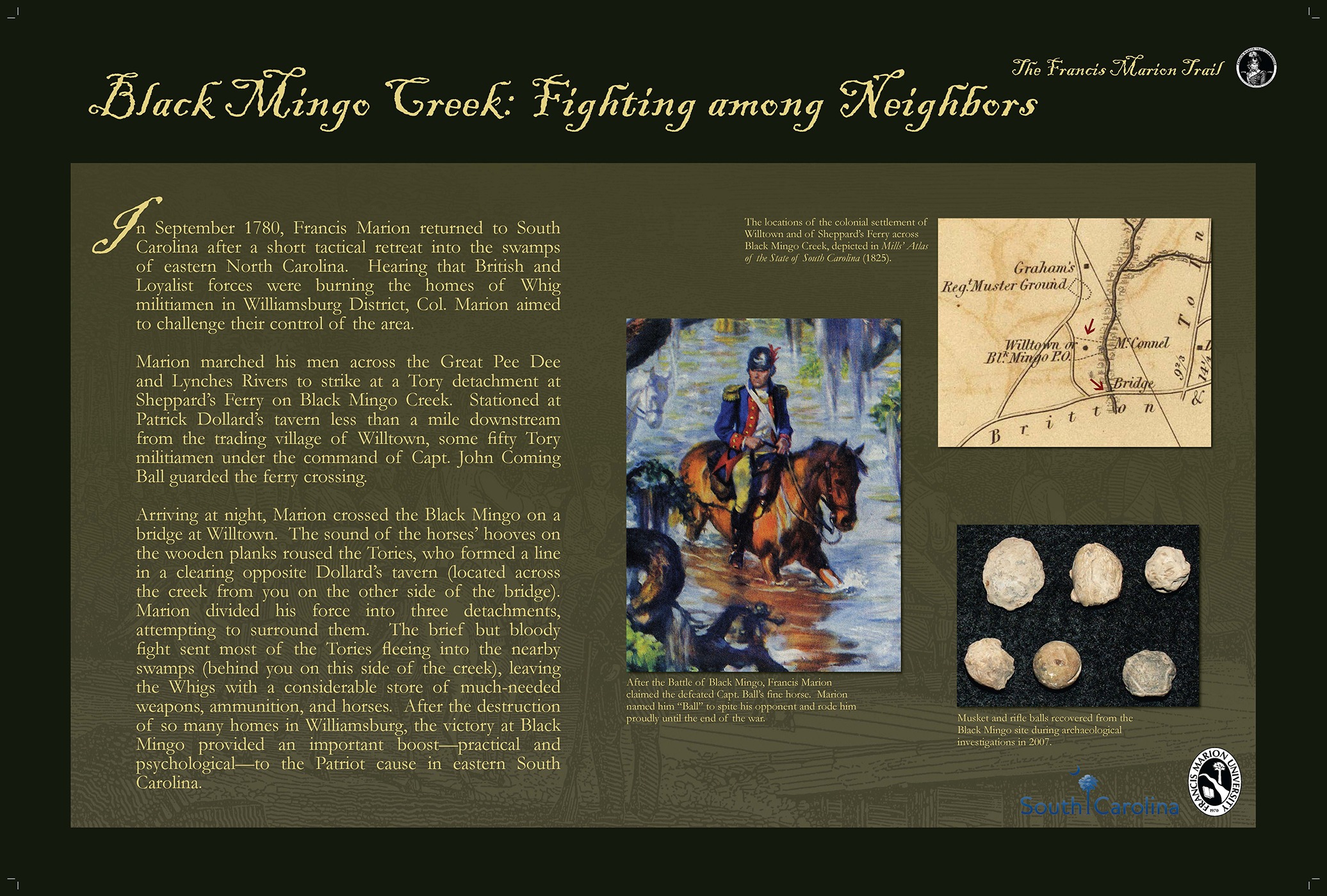
From Witherspoon’s Landing, turn left back onto Old River Road / Hwy. 41 and proceed 15.2 miles to the bridge over Black Mingo Creek. About 20 yards before the bridge is a pull-off and historical marker for the Battle of Black Mingo on the right side of the highway. Beyond this marker on the left side of the highway, just before the Bridge abutment, is a paved ramp leading down to a boat landing. Make a left turn onto this ramp to the boat landing. The interpretive sign telling about the Battle of Black Mingo is at the edge of the water (Black Mingo Creek). You will be able to look across the creek at the site of the Revolutionary War port and crossing that was called Shephard’s Ferry. Dollard’s tavern, the epicenter of the battle, was a short distance up the hill across the highway and the old part at Willtown was about one mile up the creek from where you are standing. Travel time from Witherspoon’s landing is about 20 minutes.
- Marion Returns to Defend Williamsburg
In September 1780, Francis Marion returned to South Carolina after a short tactical retreat into the swamps of eastern North Carolina. Hearing that British and Loyalist forces were burning the homes of Whig militiamen in Williamsburg District, Col. Marion aimed to challenge their control of the area.
- Targeting Tories at Sheppard’s Ferry
Marion marched his men across the Great Pee Dee and Lynches Rivers to strike at a Tory detachment at Sheppard’s Ferry on Black Mingo Creek. Stationed at Patrick Dollard’s tavern less than a mile downstream from the trading village of Willtown, some fifty Tory militiamen under the command of Capt. John Coming Ball guarded the ferry crossing.
- Surprise Attack at Willtown Bridge
Arriving at night, Marion crossed the Black Mingo on a bridge at Willtown. The sound of the horses’ hooves on the wooden planks roused the Tories, who formed a line in a clearing opposite Dollard’s tavern (located across the creek from you on the other side of the bridge). Marion divided his force into three detachments, attempting to surround them. The brief but bloody fight sent most of the Tories fleeing into the nearby swamps (behind you on this side of the creek), leaving the Whigs with a considerable store of much-needed weapons, ammunition, and horses. After the destruction of so many homes in Williamsburg, the victory at Black Mingo provided an important boost ~ practical and psychological ~ to the Patriot cause in eastern South Carolina.
STOP 5: Indiantown Presbyterian Church
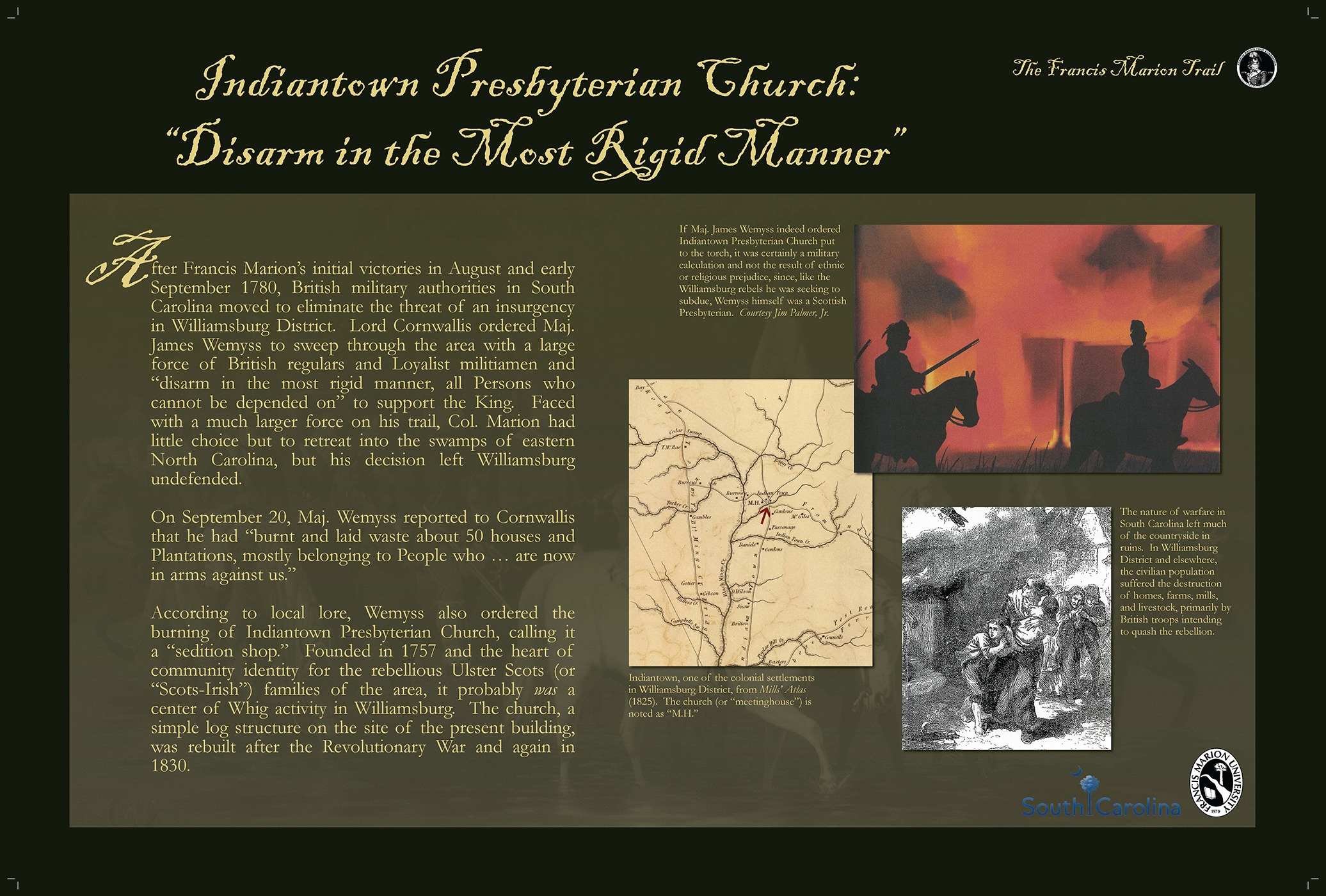
From Black Mingo Creek bridge, turn to the right back onto Hwy. 41, go 1.5 miles and turn left onto Hwy 512 West. Proceed 10.6 miles and turn left onto Hwy. 261 / 512 (also called Hemingway Highway or Henry Road) for 350 yards to Indiantown Presbyterian Church on the left. The interpretive sign is at the west end of the parking lot near the highway. This church was a center of resistance to the British. The church graveyard is very old and is the resting place for a number of people prominent in the Revolution as well as the Civil War. Travel time from Black Mingo Creek Bridge is 13 minutes.
- British Crackdown on Williamsburg
After Francis Marion’s initial victories in August and early September 1780, British military authorities in South Carolina moved to eliminate the threat of an insurgency in Williamsburg District. Lord Cornwallis ordered Maj. James Wemyss to sweep through the area with a large force of British regulars and Loyalist militiamen and “disarm in the most rigid manner, all Persons who cannot be depended on” to support the King. Faced with a much larger force on his trail, Col. Marion had little choice but to retreat into the swamps of eastern North Carolina, but his decision left Williamsburg undefended.
- Weymss’ Scorched Earth Campaign
On September 20, Maj. Wemyss reported to Cornwallis that he had “burnt and laid waste about 50 houses and Plantations, mostly belonging to People who … are now in arms against us.”
- Indiantown Church in the Crosshairs
According to local lore, Weymss also ordered the burning of Indiantown Presbyterian Church, calling it a “sedition shop.” Founded in 1757 and the heart of community identity for the rebellious Ulster Scots (or “Scots-Irish”) families of the area, it probably was a center of Whig activity in Williamsburg. The church, a simple log structure on the site of the present building, was rebuilt after the Revolutionary War and again in 1830.
STOP 6: Battle of Kingstree
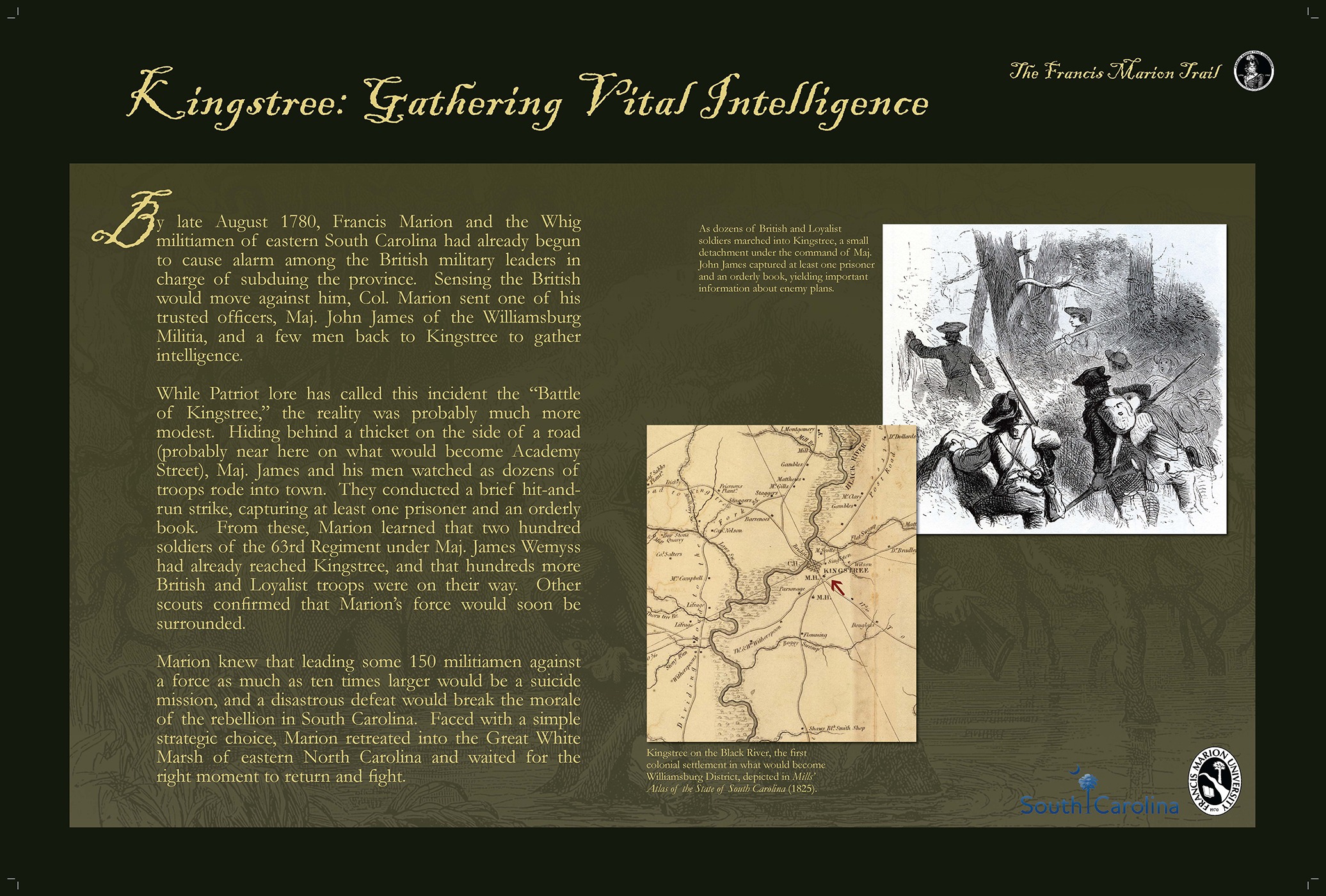
Turn left from Indiantown Presbyterian Church back onto Hwy 261 / 512 (Hemingway Road) and proceed west towards Kingstree for 17.3 miles. Go through several traffic lights on Hwy. 261 and turn right onto Academy Street in the downtown area. Go 4.5 blocks to an intersection with Kelly Street and you will see Kellahan Park in front and to the right of your position. Park beside Kellahan Park and enter the fenced area. The interpretive sign for the Battle of Kingstree is near the center of the park at an intersection of walkways. Travel time from Indiantown is approximately 19 minutes.
- Rising Alarm in British Ranks
By late August 1780, Francis Marion and the Whig militiamen of eastern South Carolina had already begun to cause alarm among the British military leaders in charge of subduing the province. Sensing the British would move against him, Col. Marion sent one of his trusted officers, Maj. John James of the Williamsburg Militia, and a few men back to Kingstree to gather intelligence.
- Skirmish on Academy Street
While Patriot lore has called this incident the “Battle of Kingstree,” the reality was probably much more modest. Hiding behind a thicket on the side of a road (probably near here on what would become Academy Street), Maj. James and his men watched as dozens of troops rode into town. They conducted a brief hit-and-run strike, capturing at least one prisoner and an orderly book. From these, Marion learned that two hundred soldiers of the 63rd Regiment under Maj. James Wemyss had already reached Kingstree, and that hundreds more British and Loyalist troops were on their way. Other scouts confirmed that Marion’s force would soon be surrounded.
- Retreat to the Great White Marsh
Marion knew that leading some 150 militiamen against a force as much as ten times larger would be a suicide mission, and a disastrous defeat would break the morale of the rebellion in South Carolina. Faced with a simple strategic choice, Marion retreated into the Great White Marsh of eastern North Carolina and waited for the right moment to return and fight.
STOP 7: Battle of Lower Bridge
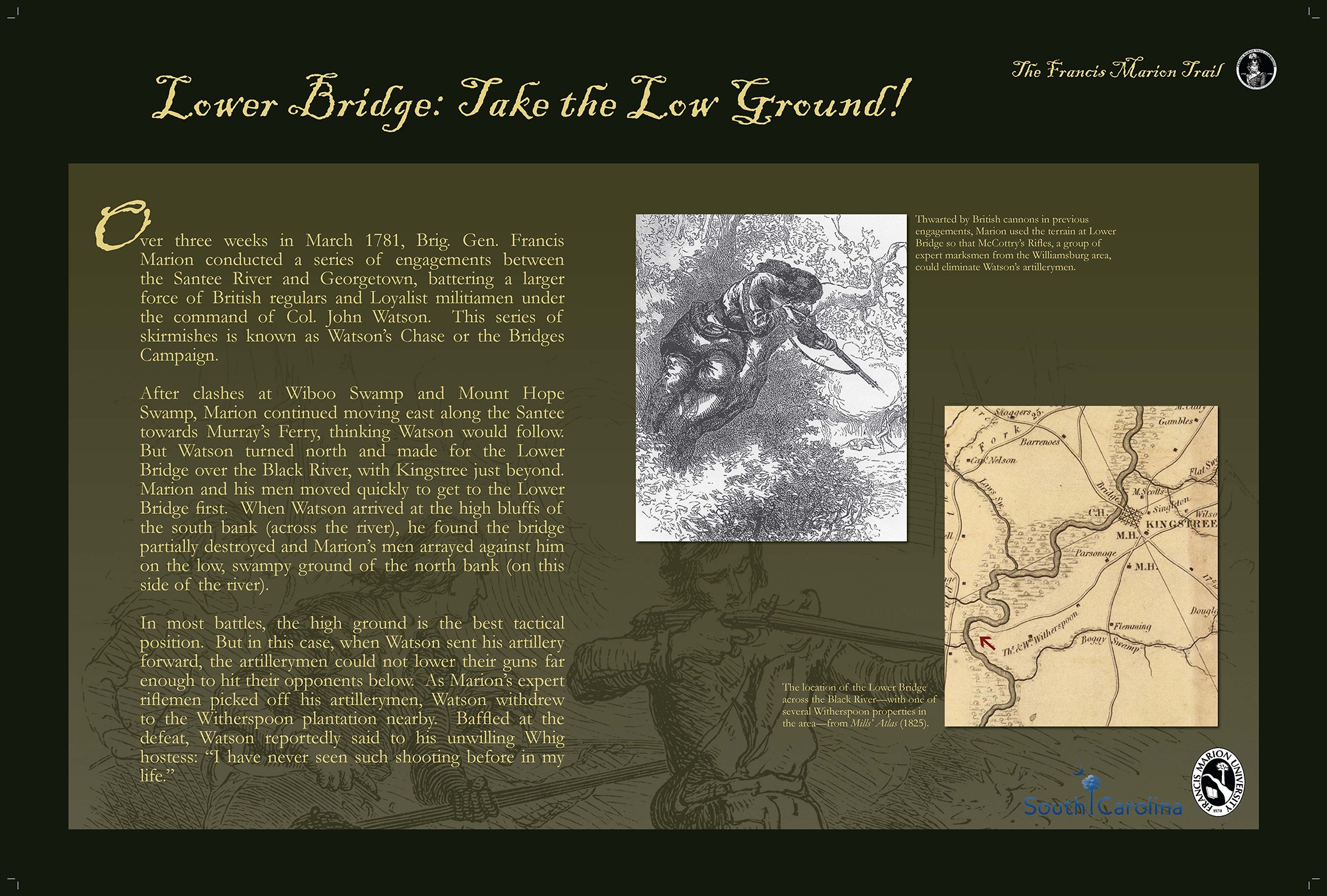
Retrace your route back down Academy Street into downtown Kingstree and turn left onto Hwy. 261. Cross the railroad tracks and go a few blocks to the intersection with Hwy. 377. Make a right turn onto Hwy. 377 towards the town of Andrews. Proceed 5.5 miles to a historical marker located at a pull-off on the right about 200 yards before the bridge crosses the Black River. There is a parking on the bridge itself and the interpretive sign for the Battle of Lower Bridge is located beside the historical marker for this same fight. It is believed the battle occurred on both sides of the Black River on the same side of this bridge as the interpretive sign. Travel time is approximately 14 minutes from Kellahan Park.
Over three weeks in March 1781, Brig. Gen. Francis Marion conducted a series of engagements between the Santee River and Georgetown, battering a larger force of British regulars and Loyalist militiamen under the command of Col. John Watson. This series of skirmishes is known as Watson’s Chase or the Bridges Campaign.
After clashes at Wiboo Swamp and Mount Hope Swamp, Marion continued moving east along the Santee towards Murray’s Ferry, thinking Watson would follow. But Watson turned north and made for the Lower Bridge over the Black River, with Kingstree just beyond. Marion and his men moved quickly to get to the Lower Bridge first. When Watson arrived at the high bluffs of the south bank (across the river), he found the bridge partially destroyed and Marion’s men arrayed against him on the low, swampy ground of the north bank (on this side of the river).
In most battle, the high ground is the best tactical position. But in this case, when Watson sent his artillery forward, his artillerymen could not lower their guns far enough to hit their opponents below. As Marion’s expert riflemen picked off his artillerymen, Watson withdrew to the Witherspoon plantation nearby. Baffled at the defeat, Watson reportedly said to his unwilling Whig hostess: “I have never seen such shooting before in my life.”
Tour Options
After Lower Bridge the tourist has several options, most of which involve proceeding about one mile further on Hwy. 377 until it intersects with Hwy. 521. The tourist can elect to end the tour at this point by turning left onto Hwy. 521 and proceeding to either Georgetown / Myrtle Beach or connecting to other roads off of Hwy. 521 to go to Charleston.
A second option is to turn right on Hwy. 521 and proceed to Manning to tour historic sites in Clarendon County. Detailed directions for a Clarendon County Tour are available below.
A third option is to turn right onto Hwy. 521, go approximately 7.5 miles to an intersection with Hwy. 52 and turn left onto Hwy. 52 to go to Berkeley County to tour sites there. Detailed directions for a Berkeley County Tour are available below.
